Arched Bridge
Arched Bridge of Portaikos River at Pyli - Main view in Pyli, Thessaly, Greece

Arched Bridge of Portaikos River at Pyli

Historic Landmark · Pyli, Thessaly, Greece

4.8(7,417 reviews)
Historic Bridge
View on Google Maps

Explore the Footprints of History

Welcome to the Arched Bridge of Portaikos River at Pyli, widely recognized as the historic Arched Bridge of Portaikos River. Located at the 22nd km of the Trikala-Arta national road in the town of Pyli, Thessaly, Greece, this 16th-century single-arch stone bridge is one of the region's most treasured landmarks.

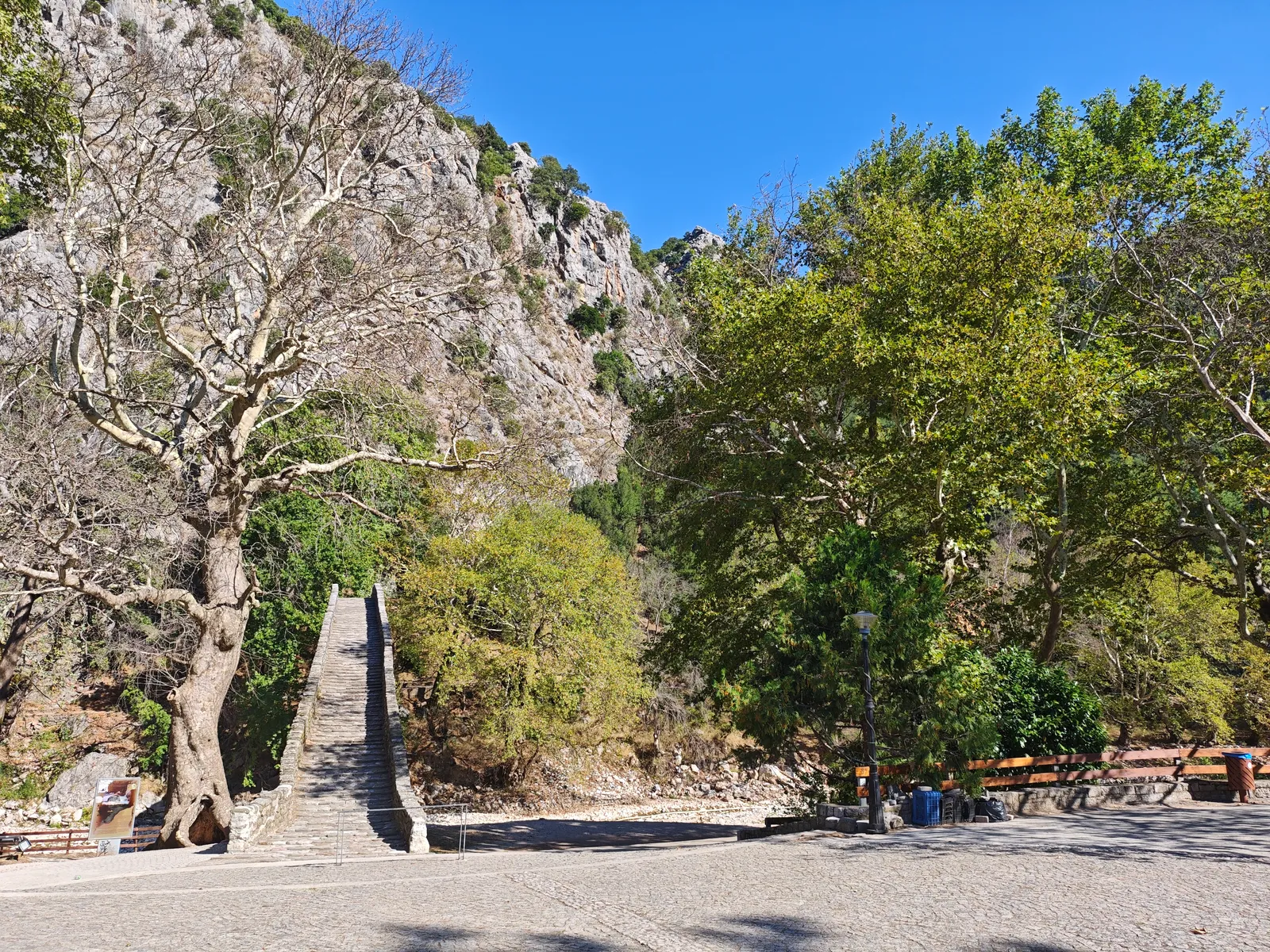
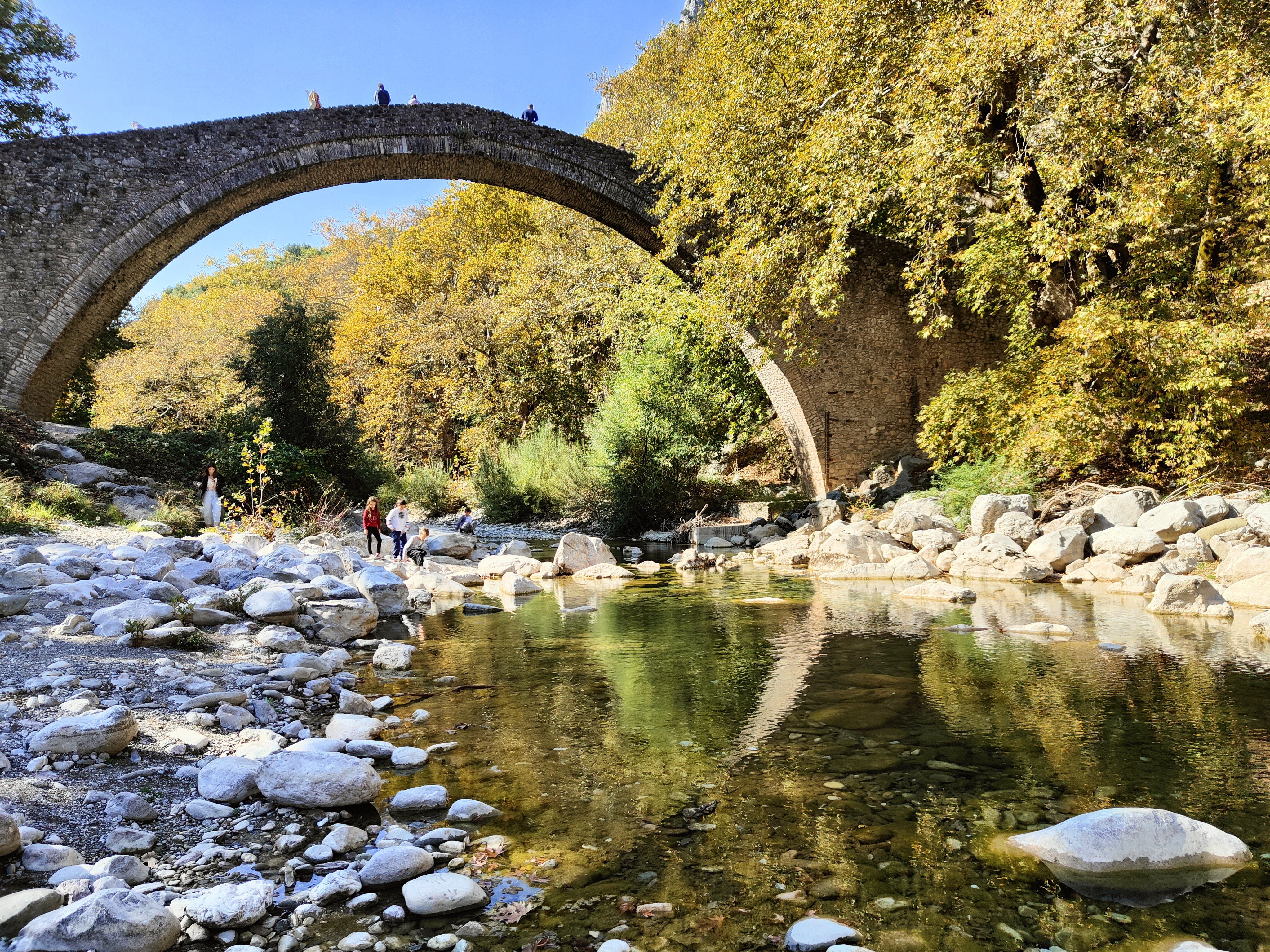
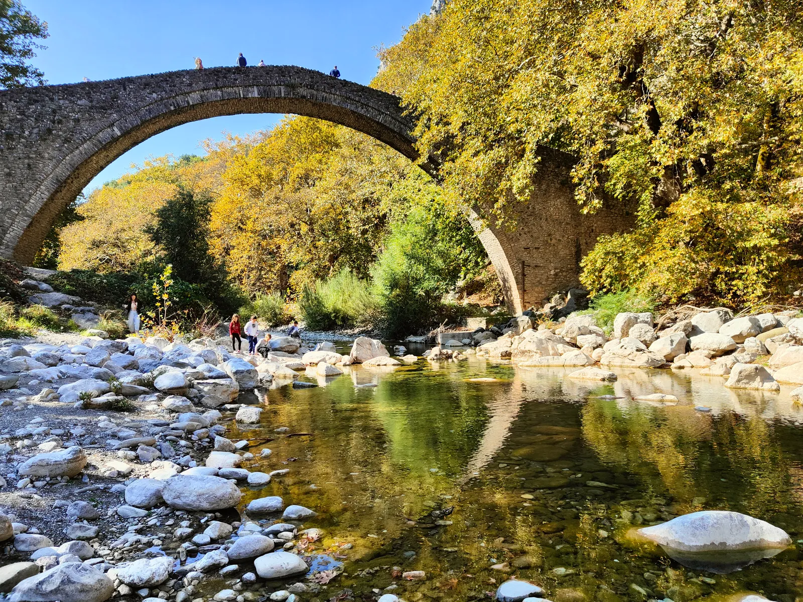
The Arched Bridge of Portaikos, built in 1514 by Saint Vissarion (Metropolitan of Larissa), is a magnificent single-arch stone bridge. It is the second largest of its kind in Thessaly and served as the sole vital connection between the Thessalian plain and the Pindos mountain villages (Epirus) for centuries. Spanning gracefully over the crystal-clear Portaikos River, flanked by towering cliffs and ancient plane trees, it represents a perfect harmony between nature and human architectural genius. Whether you are a history enthusiast, a hiker, or a photographer, this site offers an unforgettable experience.

When visiting the Arched Bridge of Portaikos River at Pyli, visitors can easily explore surrounding historical landmarks and points of interest, including the 13th-century Byzantine monastery of Porta Panagia and the scenic mountain villages of Elati and Pertouli.

Visit Guide

  • Best time for photography: Early morning or late afternoon for soft light and fewer crowds.
  • Footwear: Wear comfortable, slip-resistant shoes as the riverbank stones can be slippery.
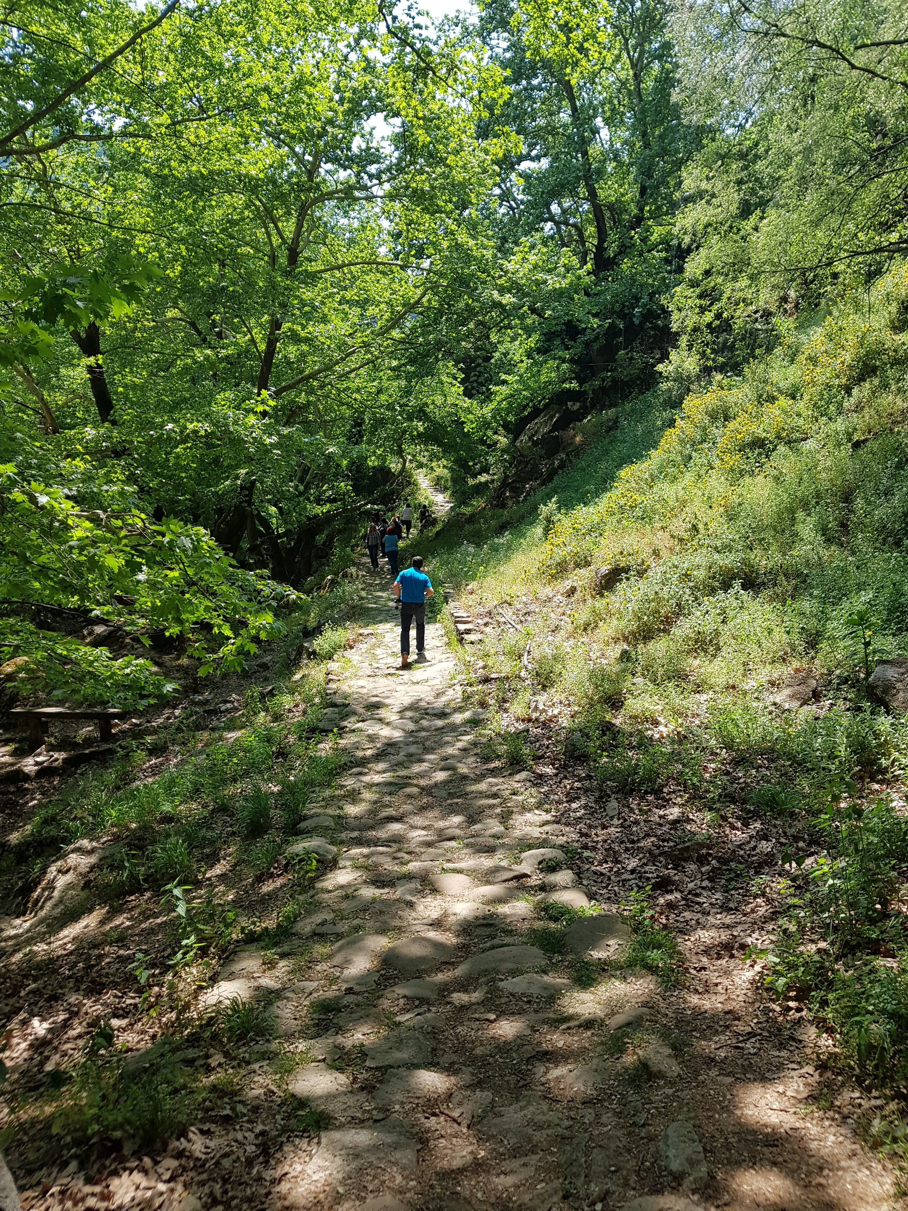
  • Exploration: Cross the bridge and follow the riverside trails to enjoy the tranquil nature.
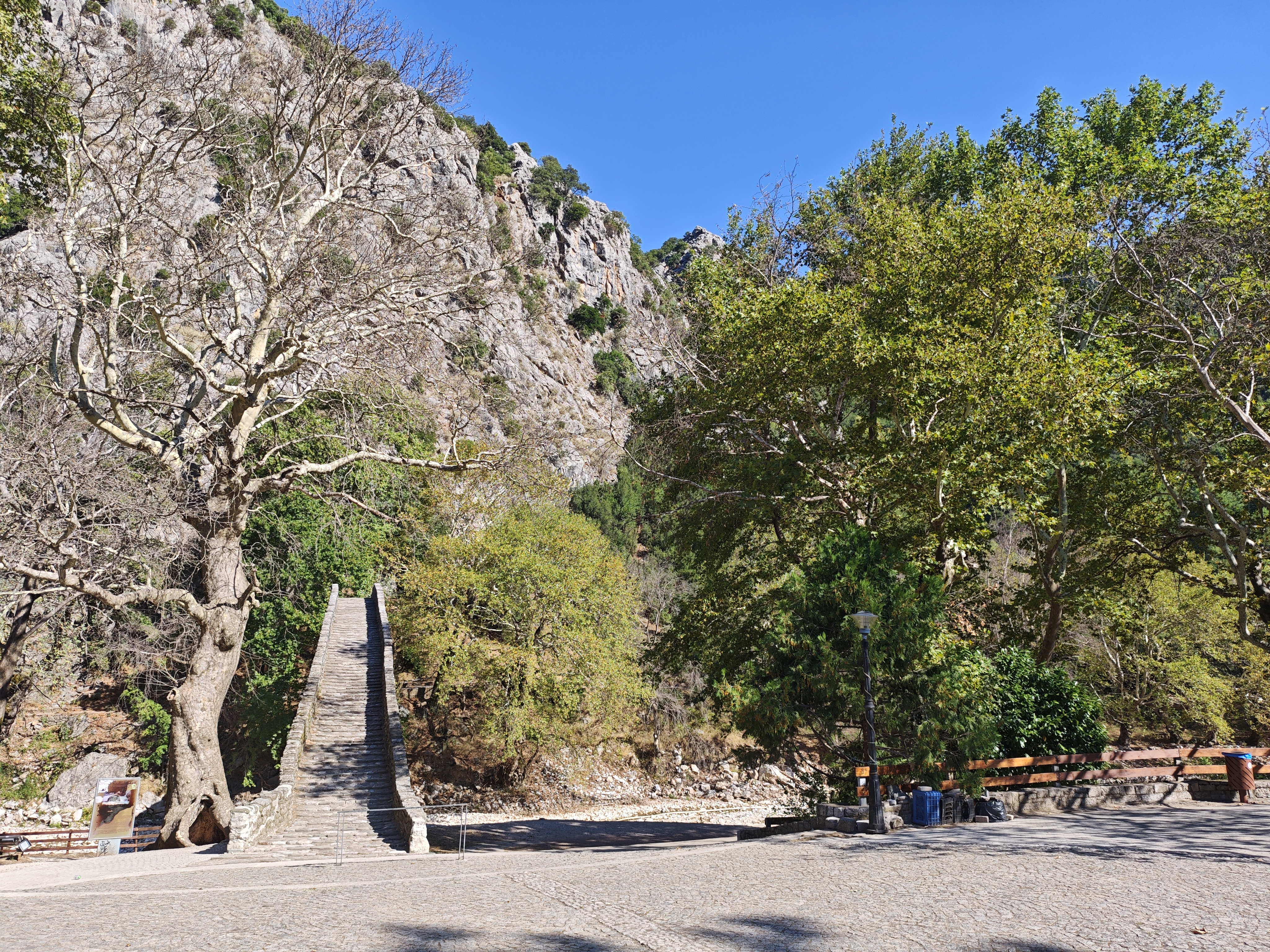
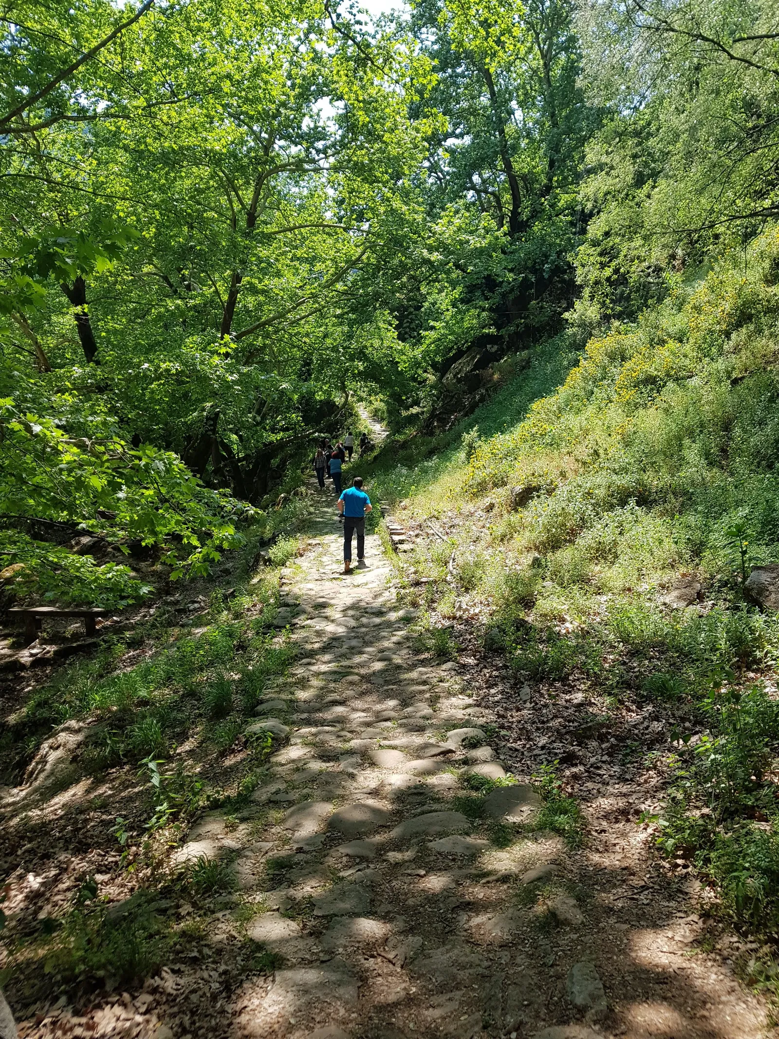
  • Accessibility: There is a short cobbled path from the main road; wheelchair access may be challenging.

Highlights

  • Ottoman-era stone architecture
  • Scenic river views
  • Traditional craftsmanship
  • Historical significance
  • Photography hotspot

About the Bridge

The Arched Bridge of Portaikos River at Pyli is a protected historical monument managed by the Ephorate of Antiquities of Trikala under the Greek Ministry of Culture.

Basic Information

Official Name

Arched Bridge of Portaikos River at Pyli

Attraction Type

Historic Bridge / Monument

Google Rating

4.8 (7,417)

Plus Code

FJ62+65 Pyli, Greece

Phone

+30 2431 076647

Address

22ο χλμ. της εθνικής οδού Τρικάλων - Άρτας, Pili 420 32, Greece

Visiting Information

Access

Open 24 hours, outdoor monument

Best Time to Visit

Spring: Mild weather, surrounding nature in bloom

Summer: Early morning or evening to avoid heat

Best Time to Visit

Autumn: Pleasant temperatures, beautiful foliage

Winter: Fewer visitors, peaceful atmosphere

The bridge is freely accessible at any time. No entrance fee required.

Admission Information

Site Visit

Free public access

Parking

Free roadside parking available

Guided Tours

Available through local tour operators

Current Weather & Multi-Day Forecast

Check this before you set off: current conditions, the feels-like temperature and the 7-day outlook for temperature, rain probability and UV index — so you know whether to pack an umbrella or sunscreen.

9°

Partly cloudy

Feels like

6°

Humidity

68% · Humid

Rain chance

98%

Wind

Force 2 · Light breeze

Gusts

13 km/h

UV index

5 · Moderate

Rainfall today

6 mm

Pack an umbrella todayBased on today's rain probability and rainfall.

Risk alerts

  • Heavy rain: the river can rise quickly. Do not go down to the riverbed or stand at the bank edge, and do not linger below the cliffs.

What to wear

  • Wind and rain expected — a waterproof jacket with breathable layers underneath.

  • Comfortable temperatures — everyday clothing is fine, with a light jacket as backup.

  • Large day-to-night swing — dress in layers and carry a jacket for early and late hours.

How to plan your visit

  • Rain will affect the outdoor experience: keep the crossing short and spend more time in Pyli town instead.

  • While the river is rising, do not go down to the riverbed — view from the roadside viewpoint and watch the water level.

What to pack

  • Rain jacket (better than a long umbrella in wind)
  • A spare jacket
  • Shoes with good grip
  • Offline map and return timetable

This site sits in a narrow river gorge: gusts are funnelled at the gorge mouth, the river can rise noticeably within hours of heavy rain, and the stone surfaces turn slippery when wet — the suggestions above are weighted for that terrain.

7-Day Forecast

Fri 16/10

17° / 8°

98%

F2

Rain

Sat 17/10

15° / 7°

60%

F2

Overcast

Sun 18/10

18° / 7°

0%

F2

Mainly clear

Mon 19/10

21° / 10°

0%

F2

Partly cloudy

Tue 20/10

20° / 11°

1%

F2

Mainly clear

Wed 21/10

19° / 9°

11%

F2

Overcast

Thu 22/10

18° / 10°

29%

F2

Fog

Each card shows the date, conditions, high/low temperature and rain probability.

Weather information refreshes automatically every 30 minutes and is provided as guidance only. · Observed at 11:00

Seasonal Visiting Strategy

Temperature, rainfall, river levels and wildlife activity all shift through the year. This overview combines the local long-term climate pattern with seasonal observation to help you pick the right time and the right gear; individual years vary.

Spring (Mar–May)

Temperature
approx. 8–22°C
Rainfall
Frequent showers, higher rainfall
River & water
Snowmelt keeps the river full and fast, water slightly turbid
Nature & wildlife
Fresh plane-tree foliage and wildflowers; birds breeding and singing at dawn
Crowds
Moderate, higher at weekends and religious holidays
Gear & tips
Waterproof shoes plus a light jacket; wet stone is slippery, and mist over the water photographs beautifully

Summer (Jun–Aug)

Temperature
approx. 20–35°C
Rainfall
Little rain, occasional afternoon thunderstorms
River & water
Low, crystal-clear water; the riverbed and pier bases are clearly visible
Nature & wildlife
Dense shade, dragonflies and cicadas; birds most active early in the morning
Crowds
Highest, especially at weekends and midday
Gear & tips
Come early or late; bring a hat, sunscreen and water; avoid prolonged exposure around midday

Autumn (Sep–Nov)

Temperature
approx. 10–25°C
Rainfall
Rainfall gradually increasing
River & water
Stable, lower flow and clear water — ideal for reflections
Nature & wildlife
Plane trees and broadleaf woods turn colour; migrating birds pass through
Crowds
Moderate to low
Gear & tips
The most comfortable walking season; pack a windproof layer. Soft light suits photography

Winter (Dec–Feb)

Temperature
approx. 0–12°C
Rainfall
Rain and snow; surrounding mountains are often snow-covered
River & water
Winter rain and snowmelt can raise levels quickly and increase the current
Nature & wildlife
Bare branches reveal the full outline of the arch; birds feed along the river
Crowds
Lowest of the year
Gear & tips
Dress warmly and watch for frost on the deck and rising water; check the forecast before travelling

Note: the table describes general seasonal patterns. For actual conditions, rely on the live weather block above and official forecasts. Do not go down to the riverbank during storms, floods or heat warnings.

How to Get Here

Whether you drive, take a taxi, arrive by coach or fly in, here is the full route to the bridge by travel mode — with journey times, reference costs and things to watch for. All times and distances are typical values; check live road conditions and official timetables on the day.

From Trikala centre

approx. 22 km

From Pyli town centre

approx. 2 km

Nearest airport

Ioannina (IOA), approx. 85 km

Road marker

22nd km, Trikala–Arta national road

By car

Journey time: approx. 25–35 min from TrikalaDistance: approx. 22 kmIndicative cost: Fuel; free parking by the bridge

Driving is the most flexible way to reach the bridge. Follow the kilometre markers along the Trikala–Arta national road and pull into the parking area at the bridge head at the 22nd km. The road is in good condition throughout.

  1. 1Search for “Pyli Bridge” in your maps app, or enter the Plus Code FJ62+65
  2. 2Follow the national road and watch for the 22nd km marker
  3. 3Park in the free roadside area — spaces are limited, so arrive before midday
  4. 4Walk a few dozen metres from the parking area to the bridge head
By taxi

Journey time: approx. 25–35 min each wayDistance: approx. 22 kmIndicative cost: approx. €30–€45 each way

Taxis can be found in Trikala and in Pyli town, and can drop you right at the bridge head. The bridge area is not a regular taxi rank, so returning vehicles are rare and the return leg needs planning.

  1. 1Pick up a taxi at Trikala railway station, the bus station or a rank in the centre
  2. 2Ask for “the old stone bridge at Pyli, 22nd km of the national road”
  3. 3Agree the fare or confirm the meter before setting off, and ask for a receipt
  4. 4Arrange a waiting time or pre-book the return pick-up so you are not stranded

From the airport

Journey time: approx. 1.5 hours from IoanninaDistance: Ioannina approx. 85 km; Thessaloniki approx. 230 km; Athens approx. 330 kmIndicative cost: Car hire or airport transfer; varies by season

The nearest airport is Ioannina National Airport (IOA). Thessaloniki (SKG) and Athens (ATH) offer far more flights but a much longer drive, so an overnight stop en route is usually worthwhile.

  1. 1From Ioannina: hire a car or change onto transport towards Trikala, roughly 1.5 hours
  2. 2From Thessaloniki: reach Trikala first (coach or rail), then continue by road — about 3–3.5 hours in total
  3. 3From Athens: consider an overnight stop in Trikala or Larissa before continuing to Pyli
  4. 4Check one-way drop-off and insurance terms before you confirm car hire

Long-distance coach (KTEL)

Journey time: Athens approx. 4.5–5 h; Thessaloniki approx. 2.5–3 hDistance: to TrikalaIndicative cost: Standard fare band — check station notices

Intercity coaches in Greece are operated by KTEL. Both Athens and Thessaloniki run direct services to Trikala; from there, transfer to regional transport for Pyli and the bridge.

  1. 1Take a KTEL coach from Athens or Thessaloniki to Trikala
  2. 2At Trikala bus station, change to a regional service towards Pyli, or take a taxi
  3. 3Schedules change around public holidays and in summer — check and book ahead
  4. 4The last return departures are early; allow a buffer

Regional bus & local connection

Journey time: Trikala–Pyli approx. 30–40 minutesDistance: approx. 22 kmIndicative cost: Low regional fare — check station notices

Regional buses run between Trikala and Pyli, but services are limited and usually reduced at weekends. From Pyli town centre it is about 2 km to the bridge, walkable or a short taxi ride.

  1. 1Check the day's departures to Pyli (Πύλη) at Trikala bus station
  2. 2From Pyli town centre, walk roughly 25–30 minutes along local roads to the bridge
  3. 3In poor weather or with limited mobility, take a taxi for the last 2 km
  4. 4Confirm the time of the last return service before you set off

By train

Journey time: approx. 4–6 hours including changesDistance: via PalaiofarsalosIndicative cost: Rail fare — check the official timetable

Trikala sits on the Palaiofarsalos–Kalabaka branch line. From Athens or Thessaloniki you normally change at Palaiofarsalos, then continue by road to Pyli. Services are infrequent and can change at short notice.

  1. 1Look up trains to Trikala or Kalabaka and the transfer options
  2. 2On arrival, take a taxi or regional bus on to Pyli and the bridge
  3. 3Re-check the timetable on the day of travel
  4. 4With heavy luggage, take a taxi for the final leg

On foot or by bike

Journey time: approx. 25–30 min walk from PyliDistance: approx. 2 kmIndicative cost: None

From Pyli town centre it is about 2 km of local road to the bridge, mixing asphalt with country lanes. Cycling works too, but traffic on the national road is fast, so take care.

  1. 1Leave Pyli town centre on the road leading towards the national road
  2. 2Watch for vehicles; some sections of country lane have no footway
  3. 3The 22nd km marker brings you to the bridge head parking area
  4. 4In summer, walk early or late to avoid the midday sun

General transport tips

  • The most reliable waypoint for the last leg is “22nd km of the Trikala–Arta national road”; the Plus Code FJ62+65 also works in most map apps.
  • Free parking by the bridge is limited — arrive before midday at weekends and on public holidays.
  • Public transport is limited and often reduced at weekends: check the day's timetable and allow a buffer.
  • Returning vehicles are rare, so agree a waiting time with your driver or pre-book the return trip.
  • Mountain roads can ice over or close in winter — check conditions and tyres before driving.
  • Public chargers near the bridge are scarce; charge in Trikala if you drive an electric car.

Visitor Facilities & Nearby Services

Neutral, type-based guidance. As a non-profit science-popularization website, we do not endorse any specific businesses.

Public Toilets

There are no dedicated public toilets directly at the bridge. The nearest public restrooms are in the town of Pyli (about 2 km away) and at fuel stations along the national road.

Parking

Free roadside parking and a small parking area are available near the bridge. Spaces are limited, so arriving by car in the morning is recommended.

Dining

Traditional Greek tavernas, cafés and bakeries can be found in Pyli town. A short walk from the bridge, small cafés overlooking the river offer drinks and light snacks.

Accommodation

Hotels, guesthouses and traditional mountain lodges are available in Pyli and the nearby mountain villages (e.g. Elati and Pertouli), about 20-40 minutes by car.

Grocery & Shops

Supermarkets, mini markets and local produce shops (including traditional local sweets) are available in Pyli town. The nearest ATM is also located there.

Fuel & EV Charging

Fuel stations are available in Pyli and along the Trikala-Arta national road. Public EV chargers are scarce near the bridge; charging in Trikala is recommended.

Accessibility & Mobility

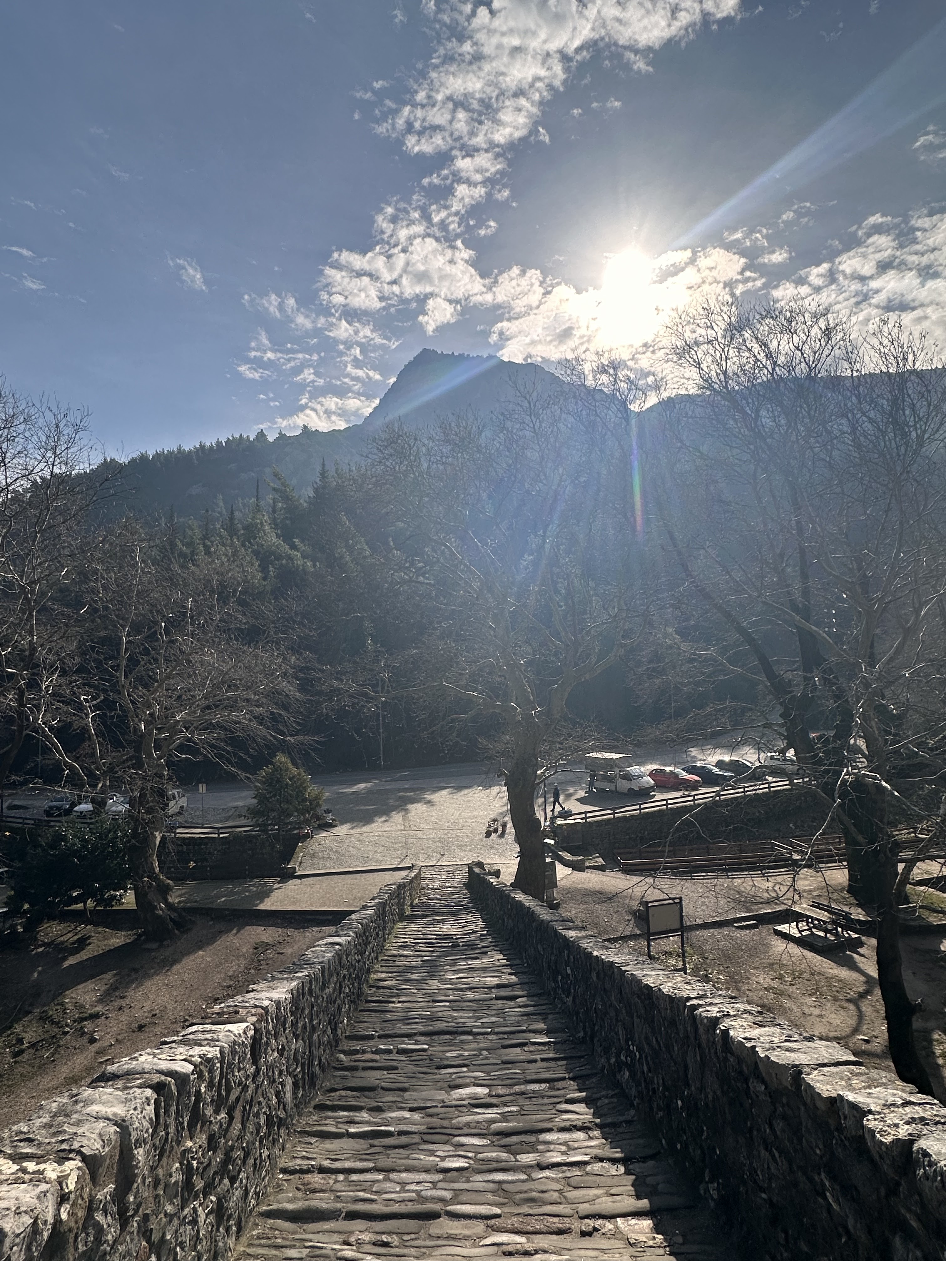
The bridge deck is stone-paved and reached by a short cobbled path from the road. The surface is uneven, with no ramps or handrails, so it is not suitable for wheelchairs or strollers; the bridge is best admired from the roadside viewpoint.

Pets

Pets are allowed on the riverside and the bridge, kept on a leash. There is no dedicated water point or waste station for pets, so please carry water and take any waste with you.

Drinking water & supplies

There is no drinking-water point at the bridge. Buy water in Pyli or Trikala beforehand and allow at least a litre per person in summer — the shade is good but there are no supplies on site.

Shade & rest

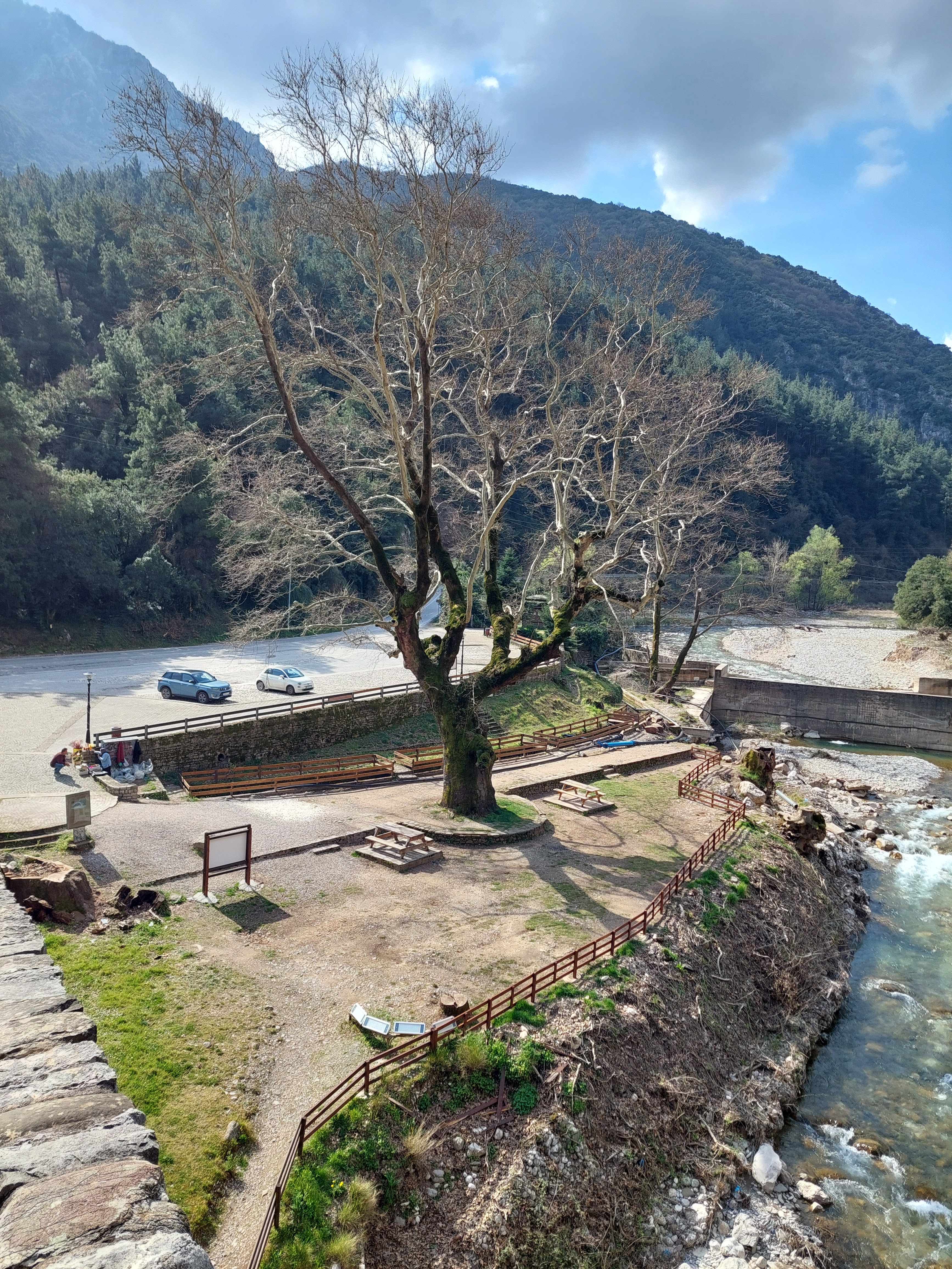
The centuries-old plane trees form a natural shaded corridor along the bank, with a few benches beneath them. Even so, midday in summer stays hot — plan your stop for early morning or late afternoon.

Medical & emergency

There is no medical post at the bridge. Pyli has primary care facilities and larger hospitals are in Trikala. In an emergency, call the pan-European emergency number 112.

Network & signal

Mobile coverage is usually good along the national road, but the gorge floor where the bridge sits can weaken the signal. Save your map and return journey details offline in advance.

Cash & payments

Bank branches and ATMs are available in Pyli town. Smaller shops and stalls near the bridge may accept cash only, so carry some small change with you.

Visitor services & nearby facilities at a glance

A type-based summary of where each service is usually found and how far it is from the bridge. No specific businesses are named. Opening hours and availability change with the season, so confirm locally before you travel.

Public toilets

Pyli town centre; fuel stations along the national road · approx. 2 km

There is no toilet at the bridge itself — sort this out before you arrive

Parking

Free roadside parking area on the national road · 0–100 m

Limited spaces; arrive before midday at weekends and holidays

Food & drink

Traditional tavernas, cafés and bakeries in Pyli; small cafés by the river near the bridge · 0.3–2 km

Traditional Greek food and light meals; opening hours vary a lot by season

Accommodation

Pyli town and mountain villages such as Elati and Pertouli · 20–40 min drive

Hotels, guesthouses and traditional mountain lodges are the common types

Groceries & convenience

Supermarkets, mini markets and local produce shops in Pyli · approx. 2 km

Good for water and snacks; shorter hours on Sundays and holidays

Fuel & charging

Fuel stations in Pyli and along the Trikala–Arta national road · 2 km and beyond

Public chargers near the bridge are scarce; charge in Trikala first

Medical & emergency

Primary care in Pyli; hospitals in Trikala · 2–22 km

In an emergency call the pan-European number 112

Cash & payments

Bank branches and ATMs in Pyli town · approx. 2 km

Smaller shops may be cash only — carry some change

Please note: the information above describes service types only. Availability may vary by season, so we recommend confirming locally before your visit.

Discover the Portaikos River Bridge

Rich History
1

Rich History

Constructed in 1514 during the Ottoman era, the bridge was funded and overseen by Saint Vissarion (Agios Vissarion). Until a modern road bridge was built in 1936, it was the only passage connecting the Thessalian plain with the Pindos mountains, playing an irreplaceable role in local trade and transport.

Architectural Marvel
2

Architectural Marvel

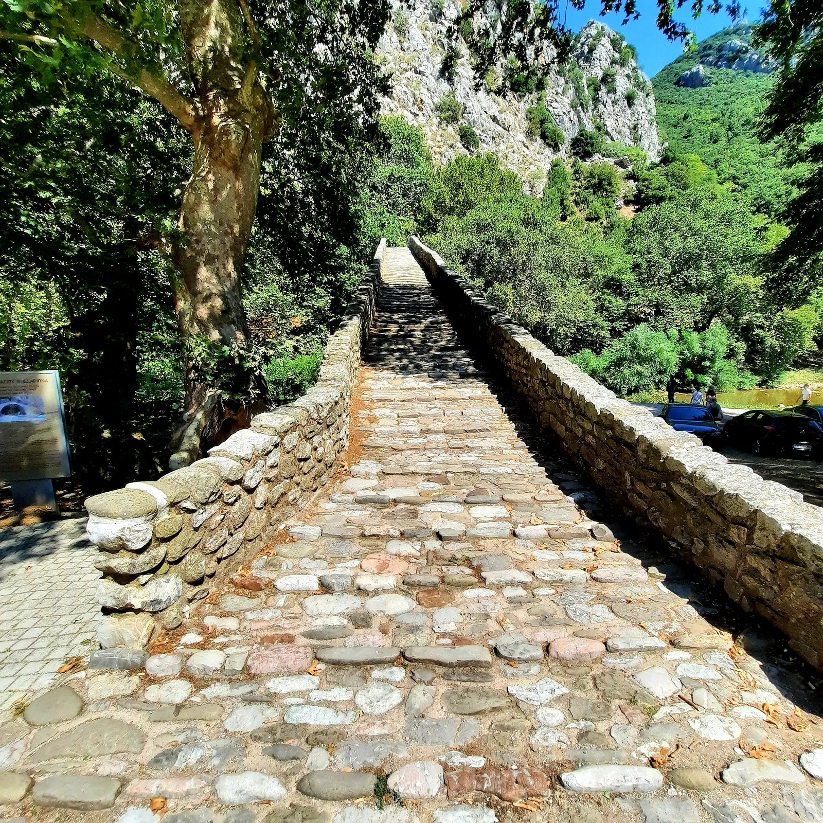
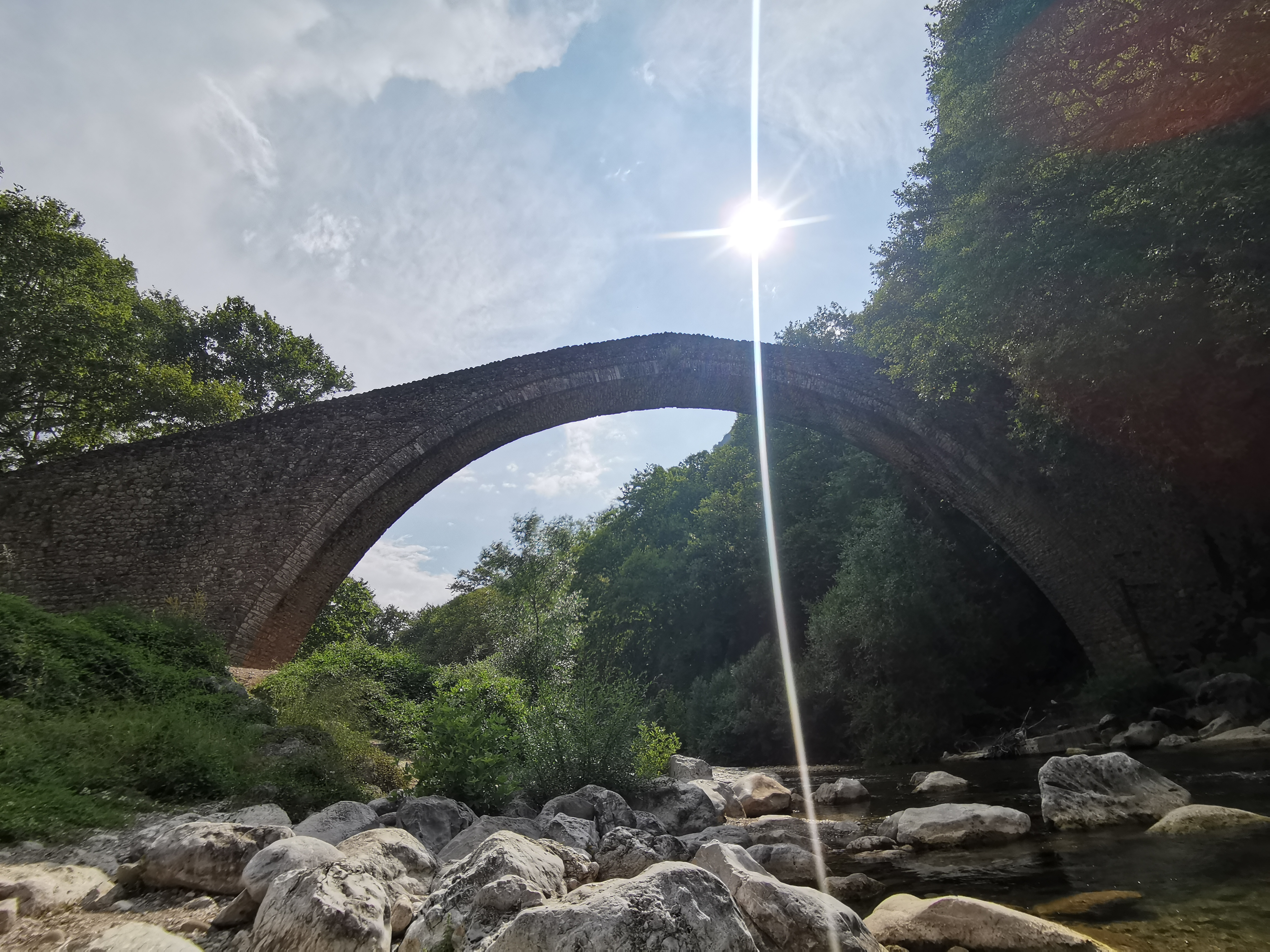
As the second largest single-arch stone bridge in Thessaly, it boasts a span of 29 meters, a maximum height of 13 meters from the water, and a deck width of 2.1 meters. Built primarily with local limestone (rubble masonry), its elegant semi-circular arch showcases the masterful skills of 16th-century craftsmen.

Stunning Natural Landscape
3

Stunning Natural Landscape

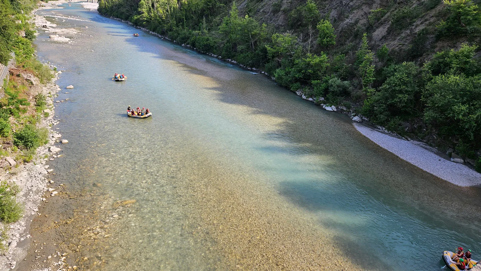
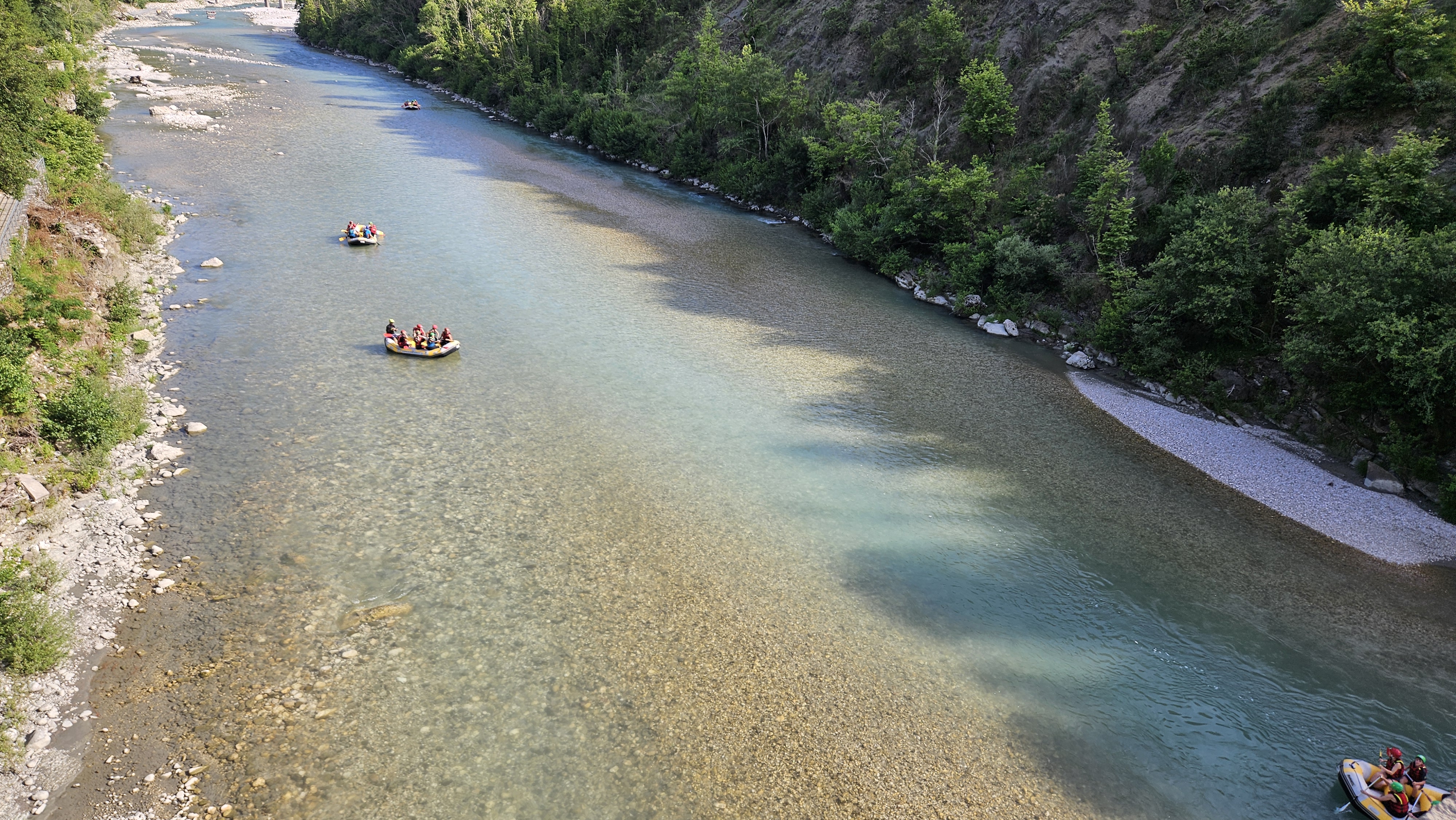
The bridge is nestled in a narrow gorge of the Portaikos River, surrounded by the lush Pindos mountains. Massive centuries-old plane trees line the riverbanks, while crystal-clear waters rush beneath the arch, creating a picturesque natural scenery.

Nearby Attractions
4

Nearby Attractions

Close to the bridge, you can visit the 13th-century Byzantine church of Porta Panagia. The scenic mountain villages of Elati and Pertouli are also just a short drive away, offering perfect spots to experience local culture and traditional cuisine.

Protected Heritage
5

Protected Heritage

The bridge is a declared protected historical monument supervised by the Ephorate of Antiquities of Trikala under the Greek Ministry of Culture. Restoration campaigns in 1968, 1983 and 2005-2006 have preserved its original 16th-century masonry for visitors today.

Experience It Today
6

Experience It Today

Visitors can walk across the bridge, follow the riverside trails, and even swim or fish in the clear waters of the Portaikos River, as locals have done for generations. Benches beneath the plane trees invite you to pause and enjoy the sound of the water.

History, Legend & Legacy

Few monuments tell the story of an entire region like the Arched Bridge of Portaikos River at Pyli. Its stones speak of a 16th-century saint, a vital trade route, and the enduring bond between the Thessalian plain and the mountains of Pindos.

The Legend of Saint Vissarion's Bridge

Local tradition (παράδοση) holds that the bridge was built in 1514 by Vissarion, who later became Metropolitan of Larissa and is venerated as Saint Vissarion, the patron saint of the Trikala region. A marble inscription set into the bridge's base still records this founding year and his name, making it one of the best-documented medieval bridges in Thessaly. According to tradition, the bridge was conceived to open a safe crossing for travelers, traders and villagers between the Thessalian plain and the mountain communities of Epirus — a purpose it faithfully served for more than four centuries.

Why "Porta"? A Gate to the Mountains

The bridge's Greek name — "Porta" (gate) — is no accident. It stands where the Portaikos River cuts a narrow gorge through the mountains, forming a natural gateway to the high villages of Koziakas. Whoever passed from the plain into the mountains had to cross here, which is why the town of Pyli itself takes its name from the Greek word "pyli" (Πύλη), meaning "gate".

Saint Vissarion: The Man Behind the Bridge

Born around 1490 in Megala Pyla (the settlement around today's Porta Panagia), Vissarion entered monastic life as a youth and later became Metropolitan of Larissa (1520). He rebuilt churches, founded schools, cared for the poor, and established the Monastery of the Holy Saviour, known as Dousiko Monastery, near his birthplace — endowed with foundation charters confirmed by the Ecumenical Patriarchate in 1536. The marble inscription of 1514 on the Pyli bridge records his name as its founder. He reposed on 15 September 1540 and is venerated as Saint Vissarion, wonderworker and patron saint of the Trikala region.

Engineering of a Single Arch

The bridge is a single semicircular arch with a span of 28.76 m and a rise of 12.77 m — among the largest in Thessaly. Its fabric is dry-laid rubble masonry (αργολιθοδομή) of local limestone and sandstone; the arch ring is built from roughly shaped stones without any metal ties. The gently humpbacked deck, only 2.10 m wide, rises toward the crown to help distribute the load, while triangular cutwaters shield the pier bases from floods. For more than 500 years it has withstood river floods and earthquakes.

The Ottoman era and the stone-bridge tradition of Thessaly

In 1514 Thessaly was still under Ottoman rule. Trade, pilgrimage and seasonal transhumance between the plain and the mountains were intense, while mountain rivers ran high in winter and spring and fords were regularly cut off. Building high, single-arch stone bridges from local stone was therefore a shared engineering tradition across western Greece and the Thessalian mountains — the Zagori bridges of Epirus and the foothills of Koziakas in Thessaly both preserve groups of bridges from the same period. The Pyli bridge is among the largest and best preserved of that tradition.

Daily life on the trade route

Until 1936, mule trains carrying grain, wool, salt and timber passed this way in and out of the mountains; shepherds moved their flocks between the plain and the high pastures with the seasons; villagers carried produce down to the markets of Trikala. The deck is only about 2.1 m wide — just enough for two laden animals to pass — and that measurement is itself evidence of the traffic it carried. The shade at the bridge head was the natural resting place, where people waited for the water to drop, for daylight, or for company before moving on.

The marble inscription of 1514

A marble slab set into the bridge records the year 1514 and the name of its sponsor, Vissarion. Few Greek stone bridges preserve both an exact date and a named founder, which is why the Pyli bridge is regarded as one of the best documented medieval bridges in Thessaly. The inscription is the bridge's most reliable birth certificate — and the reason we can separate documented history from later legend.

Bridge legends and folk songs

Greek folklore is rich in songs and legends about stone bridges. The best known is the ballad of the Bridge of Arta (Γεφύρι της Άρτας): the structure collapses again and again until the builder's wife is immured in its foundations. This motif of a sacrifice that stabilises the bridge is widespread across the Balkans. Note, however, that no such tradition attaches to the Pyli bridge: its story centres on a saint who funded the crossing, not on a sacrifice. That difference is exactly why fact and legend should be told separately.

After 1936: from thoroughfare to monument

In 1936 a modern road bridge opened on the national road and traffic stopped crossing the five-hundred-year-old stone arch. It changed from the only crossing into a cherished memory: no longer carrying loads, and precisely for that reason retaining its original masonry. After Thessaly joined the Greek kingdom in 1881, engineering works of the Ottoman period like this one were gradually reassessed and recorded, their value shifting from practical to historical and symbolic.

Restoration and conservation approach

The campaigns of 1968, 1983 and 2005–2006 concentrated on loose masonry, deck drainage and bank scour, following a minimum-intervention approach with original materials and techniques: every stone that could be kept was kept, and new material remains distinguishable from the historic fabric. The bridge is still monitored and managed by the Ephorate of Antiquities of Trikala under the Greek Ministry of Culture.

Timeline

1514

Construction

The bridge is built with local limestone and sandstone under the sponsorship of Vissarion, as recorded on a marble inscription.

1520

Metropolitan of Larissa

Vissarion is elected Metropolitan of Larissa; he goes on to rebuild churches, found schools and establish the Dousiko Monastery near his birthplace.

1540

Repose and veneration

Vissarion reposes on 15 September and is later venerated as Saint Vissarion, patron saint of the Trikala region.

1514-1936

The Only Crossing

For more than four centuries, the bridge is the sole link between the Thessalian plain and Epirus, carrying trade, livestock and people.

1881

Thessaly joins the Greek kingdom

Thessaly is incorporated into the Greek kingdom; the Ottoman-era bridge is reassessed and gradually shifts from infrastructure to heritage.

1936

A New Road Bridge

The opening of a modern road bridge relieves the old stone bridge of traffic; it remains a treasured historic monument.

1968-1983

First Restorations

Two restoration campaigns stabilize the historic structure.

2005-2006

Modern Restoration

A comprehensive restoration and landscaping project returns the bridge to excellent condition.

Today

Protected Monument

The bridge is a declared protected historical monument, managed by the Ephorate of Antiquities of Trikala.

Dimensions at a Glance

65.67 m

Total length

28.76 m

Arch span

12.77 m

Arch height

2.10 m

Deck width

1514

Built

Limestone

Material

Science & Visitor Responsibility

This bridge has stood for five centuries because structure, rock and water found a balance. Whether it stands for five more depends on how every visitor behaves.

The science behind the scene

Four short explanations will help you read what is in front of you: why the bridge stands here, where the water comes from, what lives in the valley — and how a stone arch with no steel has carried five hundred years of loads.

1

Gorge and bedrock

The site sits where the Portaikos has cut a narrow gorge through the mountain, exposing limestone and sandstone on both banks. Long-term downcutting created the steep walls — and gave a single wide arch the natural abutments it needed. That is exactly why the builders chose this spot.

2

River hydrology

The Portaikos rises in the Koziakas massif of the Pindos range. Its flow is strongly seasonal: winter and spring rain plus snowmelt make it full and fast, while summer and autumn flows drop markedly. Understanding this explains why the bridge has cutwaters at its base.

3

Valley ecology

Centuries-old plane trees form a shaded corridor along the banks, providing habitat for birds, amphibians and insects. The clear, oxygen-rich water is an important habitat for local fish. Spring is the breeding season — watch from a distance and avoid playback calls.

4

How the structure works

A semicircular arch carries the deck load along the arch ring into the rock on both banks. Dry-laid stones hold together through compression and friction alone, with no metal ties anywhere. Triangular cutwaters blunt the force of flood water, while the gently humped deck helps spread the load.

Visitor responsibility

This is a protected monument and a river habitat without fences or wardens — care depends on visitors themselves. Please observe the following with us:

  • No carving, painting or marking of any kind: damage to a 500-year-old stone surface cannot be undone
  • Take nothing away — no pebbles, stones or plants — and never move or restack the bridge's stones
  • Carry your litter out; bins are limited and there are none on the deck or riverbank
  • No open fires or barbecues: dry plane leaves make fire risk high
  • Do not chase, feed or capture wildlife; keep away from nesting areas during the breeding season
  • Keep pets on a lead and clean up after them; there are no pet water points or waste bins on site
  • Do not climb the arch ring, abutments or railings; when photographing, keep the walkway clear and do not occupy the narrow deck for long

Safety notes

This is an open-air monument with no gatehouse or staff on site, so please judge the conditions yourself:

  • After heavy rain the water level can rise noticeably within hours — do not go down to the riverbed or stand at the bank edge
  • Bank stones and the deck are slippery after rain, at dawn and in winter — wear shoes with good grip
  • Rockfall is possible from the steep gorge walls — do not linger directly beneath them
  • Summer midday is hot and shade is limited — drink water and avoid the 12:00–16:00 window
  • Lighting is limited after dark; plan to finish your visit around sunset
  • Keep children, older visitors and companions within sight and contact at all times

This is an independent non-profit educational project. The content above is a general introduction and is not professional engineering, meteorological or rescue advice; if conditions on site differ, follow local official notices and signage.

Routes by Traveller Type

The same bridge, three different rhythms. Pick the route that matches who you are travelling with — family, photography and nature interests, or a low-effort, step-free visit.

Families with children

approx. 1.5–2 hoursRelaxed pace

Short walks and safe viewpoints turn the 500-year-old bridge into an open-air classroom: how an arch carries load, counting the stones, watching water and shadows.

Route highlights

  • Start at the roadside viewpoint: explain how an arch stands up before walking onto the deck
  • On the bridge head, play “spot the difference” between arch stones and deck stones
  • Observe the current, pebbles and tree reflections from the gentle bank — keep a safe distance from the water
  • Finish with a local pastry in Pyli town centre

Good to know

  • The deck is only about 2.1 m wide with no railings — hold children's hands at all times
  • Pushchairs struggle on the cobbled section; a child carrier works better
  • Avoid midday in summer and watch for frost on the deck in winter

Photography & nature

approx. 3–4 hoursFlexible pace

Plan around the light: reflections downstream at dawn, shaded stone and plant details at midday, then the full arch from higher ground in the evening.

Route highlights

  • Dawn: low angle on the downstream bank for the arch and its reflection
  • Morning: close-ups of the deck and voussoirs — side light reveals the stone texture
  • Midday: macro subjects and riverside ecology in the shade of the plane trees
  • Evening: the high viewpoint across the road for the full span in warm light

Good to know

  • Keep tripods clear of the walking route; the narrow deck should not be blocked
  • After rain the stones are slick — assess water level and current before approaching the bank
  • If you fly a drone, follow local regulations and avoid flying over visitors or the road

Low-effort & step-free

approx. 45–60 minutesGentle pace

No bridge crossing and no riverbank: stay on the roadside viewing area and the level ground at the bridge head. The full single arch and the gorge are still clearly visible — suitable for older visitors, anyone with limited mobility and wheelchair users.

Route highlights

  • Level roadside viewpoint with a straight-on view of the whole bridge — the least effort, best reward
  • Level ground at the bridge head for a closer look at the arch ring and abutments
  • A shaded rest spot to listen to the water and take in the gorge
  • Return to Pyli town centre for refreshments; almost no ascent anywhere

Good to know

  • The cobbled path to the bridge head is uneven with no ramps or handrails — difficult for wheelchairs and walking frames
  • Come with a companion and choose a viewing point where the car can stop directly
  • Seek shade and water in summer, wrap up warm in winter

Recommended Visiting Routes

Two ready-made routes — a half day and a full day — both starting from the parking area on the national road. Mix and match them according to your arrival time, stamina and who you are travelling with.

Half-day route

approx. 2–3 hours
  1. 1

    Drive the Trikala–Arta national road to the 22nd km and park in the roadside parking area

  2. 2

    Start at the roadside viewpoint for the full picture before approaching

  3. 3

    Walk across the historic arch, noting how the voussoirs differ from the deck stones

  4. 4

    Descend to the gentle bank and shoot the arch from downstream, if the water level allows

  5. 5

    Rest in the shade of the plane trees, listening to the water and watching the riverside habitat

  6. 6

    Return to Pyli town centre for food or supplies

Full-day route

approx. 6–8 hours
  1. 1

    Set off early to photograph the bridge and its reflection in morning light

  2. 2

    Complete a full circuit of the deck and the gentle bank, noting the masonry detail

  3. 3

    Head about 2 km to the 13th-century Byzantine church of Porta Panagia

  4. 4

    Lunch in Pyli town centre and walk the traditional streets

  5. 5

    Continue to the mountain villages of Elati or Pertouli for the highland landscape

  6. 6

    Return to the bridge in the evening for the arch from the higher viewpoint at sunset

  7. 7

    Stay overnight in Pyli or a mountain village, or drive back to Trikala the same day

Notes for both routes

  • The bridge is free and open at all hours; early morning and evening have the best light and fewest people
  • Both routes work best with a car; public transport is limited, so check timetables in advance
  • The deck is narrow with no railings — cross in small groups if you are a larger party
  • In summer, schedule the strenuous parts early or late and use midday for food and rest
  • In wet weather, switch to the “viewpoint plus town” combination and skip the riverbank

Top Photo Spots

1

Bridge Arch View

Riverside

Capture the full arch structure from the river bank.

2

River Perspective

Downstream

View the bridge from downstream with water in the foreground.

3

Stone Detail

Bridge structure

Close-up of the traditional stone masonry work.

4

Panoramic View

Hillside viewpoint

Wide angle view showing the bridge in its natural setting.

Visitor Reviews

Reviews can be viewed via Google Maps.

J
John D.
2026-03-10

Beautiful historic bridge with amazing stonework. The location is scenic and peaceful. A must-visit if you're in the area.

M
Maria K.
2026-02-15

Impressive engineering for its time. The bridge has stood the test of time and remains functional. Great for history enthusiasts.

G
George P.
2026-01-20

Visited with family. The kids were fascinated by the old bridge. Nice spot for photos and a quick stop.

E
Elena S.
2025-12-05

A hidden gem in Thessaly. The bridge is well-preserved and the surrounding nature is beautiful, especially in spring.

N
Nikos A.
2025-11-18

Historic and picturesque. The access is easy from the main road. Would recommend combining with a visit to Pyli town.

A
Anna M.
2025-10-22

Love the architecture and history. It's free to visit and open anytime. Perfect for a quick historical stop.

Frequently Asked Questions

The Arched Bridge of Portaikos River is located at the 22nd km of the Trikala-Arta national road, in the town of Pyli, Thessaly, Greece (Plus Code FJ62+65, Pili 420 32).

Map Location

22ο χλμ. Τρικάλων - Άρτας, Pili 420 32, Greece

Sources & Credits

This is an independent, non-profit educational website. The information presented here is compiled from the official public sources listed below.

Note on sources: the bridge's construction year (1514) and the name of its founder are recorded on a marble inscription set into the bridge itself. Stories about Saint Vissarion's life draw on local tradition and hagiography; where historical and legendary accounts differ, this is noted in the text.

Data and content last reviewed: 20 September 2026.